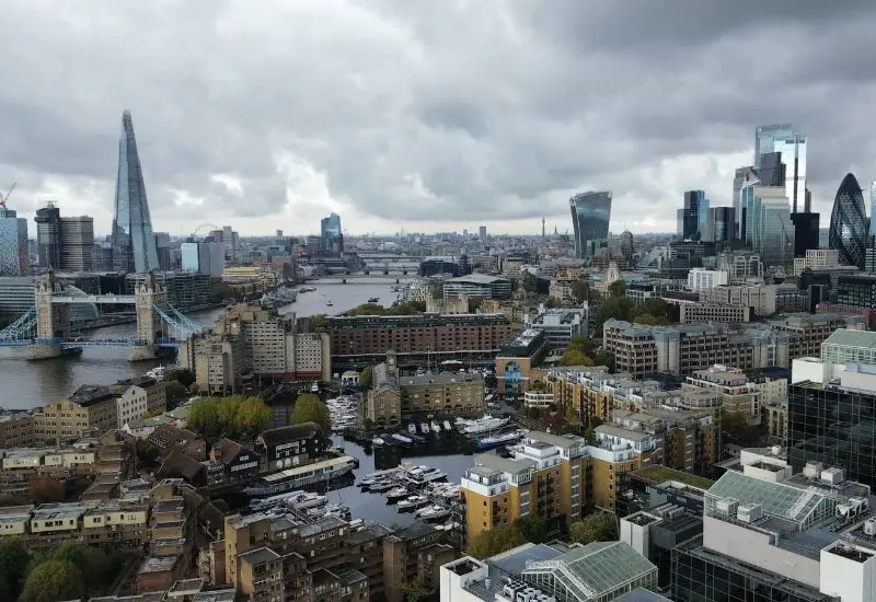
Accessing high-level building elements – such as complex roof structures, chimney stacks, and multi-storey façades – has traditionally been a costly and logistically challenging exercise. At MM Building Surveyors, we are qualified and licensed to pilot drones (UAVs), providing our clients with a safe, rapid, and highly detailed method of inspection. By integrating aerial technology into our surveying practice, we provide a forensic view of building condition that was previously difficult or impossible to obtain without expensive temporary works.
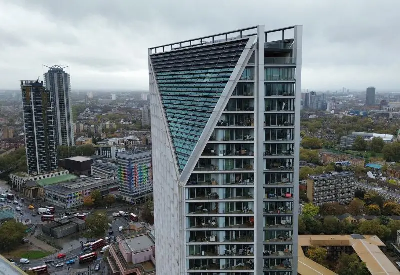
The use of drones allows us to identify defects that are often invisible from the ground. Whether we are inspecting a high-rise residential block or an expansive industrial estate, our aerial surveys provide high-quality video and photographic imagery that forms a critical part of our professional reporting.
A Drone Survey from MM Building Surveyors delivers:
Cost Efficiency: Avoiding the significant expense and time required for scaffolding, access towers, or mechanical lifts (MEWPs).
Rapid Deployment: Inspections can often be carried out in a single visit with minimal disruption to building occupiers.
Detailed Evidence: High-resolution 4K imagery provides undeniable proof of condition for legal and insurance purposes.
Enhanced Safety: Reducing the need for surveyors to work at height on fragile or inaccessible structures.
Our licensed pilots operate throughout London, Hertfordshire, Bedfordshire, and Buckinghamshire, ensuring all flights are conducted in accordance with CAA regulations.
Drone surveys are particularly beneficial for modern compliance audits. We utilise aerial imagery to assist in the inspection of external wall systems for Cladding and Fire Safety reports. Furthermore, for buildings suspected of containing RAAC Surveys, drones allow us to inspect the external roof deck for signs of ponding or deflection that may indicate a structural risk below.
Our aerial capabilities also support Development Monitoring for funders and Project Management for large-scale refurbishments, providing a bird’s-eye view of site progress. In legal matters, high-resolution drone photography provides authoritative evidence for Expert Witness testimony and Dilapidations negotiations.
While a drone cannot physically touch a material to test for rot or strength, its high-resolution cameras can zoom in closer than the human eye can see from a ladder. It is an exceptional tool for identifying visual defects like cracked tiles, failing leadwork, or blocked gutters, which then informs whether a more hands-on Defect Diagnosis is required.
Yes, we must follow Civil Aviation Authority (CAA) regulations. Certain areas near airports or high-security sites may require special permissions. As licensed pilots, we manage all the necessary paperwork and flight planning to ensure the survey is compliant.
Absolutely. The clear, time-stamped photographic evidence from a drone survey is ideal for Reinstatement Cost Assessments and for documenting damage following a storm or fire, providing insurers with the technical proof they require to process a claim.
We would love to speak with you. Feel free to reach out using the below email or form.
office@mmbuildingsurveyors.co.uk